Boat navigation is the foundation of safe and confident boating. Whether you’re cruising coastal waters or heading offshore, knowing how to find your position and plot a safe course makes every trip more enjoyable. Modern GPS technology has made navigation easier than ever, but understanding traditional methods gives you reliable backup when electronics fail. From reading nautical charts and using a compass to mastering chartplotters and following navigation rules, these skills transform uncertainty into confidence on the water. Learn the essential tools, coastal versus offshore techniques, and smart navigation practices that keep you on course every time you cast off.
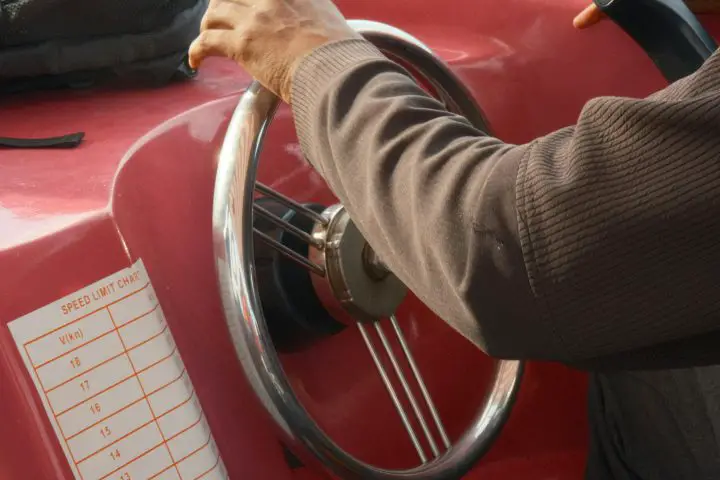
Table of Contents
- Types of Boat Navigation
- Essential Navigation Tools
- Reading Nautical Charts
- Understanding GPS Navigation
- Coastal vs Open Sea Navigation
- Safety and Rules of Navigation
- Common Navigation Mistakes
- Master the Water Like a Pro
- FAQs – The Ultimate Guide to Boat Navigation
Types of Boat Navigation
Navigation methods fall into two main categories: traditional and electronic. Both serve the same purpose—determining your position and plotting a safe course.
Celestial navigation uses stars, planets, and other celestial bodies to determine your location, with the sextant being the primary tool for measuring angles between celestial objects and the horizon. Coastal navigation uses the coastline to navigate, where boaters look for landmarks and use the shape of the coast to determine location. Dead reckoning calculates position based on previous location, speed, and elapsed time, though currents and wind can affect accuracy.
Electronic navigation methods are a modern replacement for old methods and tools, doing the same things as traditional navigation methods, only faster and more effectively. Satellite positioning uses multiple satellites to pinpoint your location and display it on a screen, providing accuracy within a few meters. Radar enhances visibility in fog or darkness by detecting objects and displaying their distance and bearing. Modern chartplotters combine GPS with electronic charts, showing real-time position, depth contours, and hazards.
Electronics can and do fail, so it’s important to gain a basic understanding of the tools you need for analog navigation. Experienced boaters use electronic navigation as their primary system while maintaining traditional navigation skills as backup. When GPS fails or batteries die, knowing how to use a compass and paper charts becomes essential for safe navigation.
Related: Can You Live on a Boat? The Complete Beginner’s Guide
Essential Navigation Tools
Every boat needs reliable navigation equipment. Here’s what matters and how to choose it.
Compass
A compass tells you which direction your boat is heading in—north, south, east, or west—as measured in degrees relative to magnetic north. Choose a compass with clear markings, a stable card that settles quickly, and a proper size for your helm visibility. Hand-bearing compasses should fit comfortably in your hand and provide easy sighting. Look for models with built-in compensation adjusters and night illumination.
GPS Systems and Chartplotters
A marine GPS chartplotter combines GPS technology with detailed marine charts to offer real-time navigation data, displaying your position on detailed electronic charts. Unlike typical GPS systems, marine chartplotters are built to withstand saltwater, intense sunlight, and moisture. When selecting a chartplotter, consider screen size for your boat type, sunlight readability, waterproof rating (IPX6 or higher), and integration capabilities with radar, sonar, and AIS. Check chart coverage for your cruising area and update frequency. Touchscreen models work well in calm conditions, but physical buttons perform better in rough weather with wet hands.
Nautical Charts
Charts are maps for boaters, and the National Oceanic and Atmospheric Association charts navigable waterways throughout the U.S. Keep both paper and electronic charts aboard. Paper charts provide reliable backup and better overall route visualization. Choose charts with an appropriate scale—large-scale for harbors and coastal areas, small-scale for offshore passages. Check publication dates and update regularly using Notices to Mariners.
Reading Nautical Charts
Nautical charts contain essential information for safe navigation. Understanding symbols and markings is crucial for route planning and avoiding hazards.
Colors show depth and land features: white equals deep water, light blue equals shallow water, dark blue equals very shallow areas, green equals intertidal zones, and tan or yellow equals land. This color coding provides immediate depth assessment.
Diamonds are buoys, squares and triangles are fixed markers, and teardrops represent lights with accompanying notes on their flashing pattern printed alongside. The basic symbol for a buoy is a diamond and a small circle, with the diamond denoting the approximate location of the buoy mooring. Slanted text indicates objects that move with tides and currents, while upright text marks fixed structures.
Depth soundings typically indicate water depth at the lowest tide, providing a safety margin during most conditions. Depth contours connect points of equal depth, showing underwater terrain. Closely spaced contours indicate steep drop-offs, while wide spacing shows gradual slopes.
Light characteristics use abbreviations like “Fl G 4s” for flashing green light every four seconds. Charts also show light range and height above water. Always check the chart legend for unfamiliar symbols, verify the chart scale for distance measurements, and note the publication date. Use latitude lines on chart edges to measure nautical miles accurately.
Understanding GPS Navigation
GPS has made precise navigation accessible to all boaters. The system works by receiving signals from multiple satellites—at least four are needed for accurate positioning. Modern marine GPS devices can pinpoint your location to within a few meters, with continuous updates several times per second.
To get from point “A” to point “B,” create a waypoint by scrolling a cursor across the chart or tapping the position on a touchscreen, then pressing the “go to” button. The chartplotter displays compass course and steering guidance. However, the most important thing about creating waypoints and routes is to look closely at the chart and make sure you won’t be crossing any major obstructions like a finger of land, restricted areas, or waters that may not afford your boat its minimum draft.
Marine navigation apps like Navionics can enhance your boating experience with user-friendly interfaces and detailed nautical charts, though boats and cell phones don’t always mix well; the moist environment and risk of shock damage are ever-present, and cell phone coverage can be sketchy or non-existent in many boating areas. Use apps as supplementary tools rather than primary navigation systems.
Coastal vs Open Sea Navigation
Navigation strategies differ significantly between coastal and offshore environments, requiring different skills and equipment.
Coastal navigation involves the conduct of a ship in the neighborhood of dangers such as rocks, shoals, shallow, confined, and congested water, and fixing the ship’s position depends on terrestrial objects such as lighthouses, buoys, towers, or masts. Coastal waters tend to be more sheltered and less exposed to extreme weather conditions, and coastal boaters can enjoy picturesque scenery and greater ease of finding shelter in bad weather. However, increased traffic near harbors and channels requires constant vigilance.
Offshore navigation is concerned with the conduct of a vessel at the open sea, which depends on electronic aids to navigation such as satellites and GPS as well as observation of heavenly bodies such as the sun, the moon, planets, and stars. Offshore sailing involves navigating in open water, far from shore and without natural protection from wind and waves, presenting significant challenges such as dealing with unpredictable weather conditions and preparing for emergencies in a remote and often inhospitable environment.
Key Differences:
- Position fixing: Coastal uses visible landmarks; offshore relies on GPS and celestial navigation
- Traffic density: Coastal areas have heavy traffic; offshore is typically uncongested
- Weather protection: Coastal waters offer nearby shelter; offshore requires self-sufficiency
- Water depth: Coastal navigation must account for shallow areas; offshore provides deep water
- Planning requirements: Coastal needs detailed local charts; offshore requires long-range fuel and provisioning
Safety and Rules of Navigation
The International Regulations for Preventing Collisions at Sea (COLREGs) not only prescribe the actions of each vessel in all states of visibility, but they also stipulate the lights that should be fitted to a vessel and the shapes that should be available. These rules govern right-of-way situations and vessel interactions worldwide.
The rules concerning lights must be complied with from sunset to sunrise and at all other times in restricted visibility. Navigation lights communicate your position, heading, and vessel type to others. Standard recreational boats display green starboard light, red port light, and white stern light.
Channel markers indicate the port and starboard limits of a narrow channel that has been dredged, and waters outside the channel may be shallow or conceal rocks and other hazards. U.S. waters follow “red right returning”—keep red markers on your right when returning from sea. Safe water marks show red and white vertical stripes. Isolated danger marks display black and red horizontal stripes.
The Coast Guard requires maintaining proper lookout, operating at safe speeds, and keeping clear of other vessels. Always check weather forecasts before departure, file a float plan, and ensure safety equipment, including life jackets, flares, VHF radio, and sound-producing devices, are aboard and functional.
Related: The Best Time to Buy a Boat – Time The Tide Right!
Common Navigation Mistakes
Understanding common errors helps prevent accidents and improve navigation skills.
Over-Reliance on electronics. GPS systems can fail, freeze, or lose signal. Batteries die unexpectedly. Tip: Cross-check electronic position with visual references and maintain traditional navigation skills as backup.
Misreading charts. Depth soundings typically indicate water depth at the lowest tide, which can lead to miscalculations during different tide stages. Ignoring the chart scale or using outdated charts causes navigation errors. Tip: Always verify the chart date, check the scale before measuring distances, and understand tidal effects on depths shown.
Ignoring weather conditions. The weather changes rapidly on the water. Small craft advisories and forecast warnings indicate dangerous conditions. Tip: Check weather reports before departure and monitor conditions continuously. Don’t hesitate to turn back when conditions deteriorate.
Not maintaining a proper lookout. Focusing too long on chartplotters or instruments causes missed hazards and collision risks. Tip: Assign dedicated lookouts when studying charts. Stay especially vigilant in channels, harbor entrances, and high-traffic areas.
Misjudging tides and currents. Water movement affects speed over ground and route planning. Strong currents can push vessels off course significantly. Tip: Check tide tables and current predictions for your area, especially near inlets, points, and areas with strong tidal flows. Factor current into speed and arrival calculations.
Master the Water Like a Pro
Mastering boat navigation means knowing both old-school methods like celestial navigation and modern GPS chartplotters. Your essential toolkit needs a reliable compass, a marine-grade chartplotter, and backup paper charts—because electronics fail. Learn to read nautical charts by understanding color-coded depths, buoy symbols, and tide effects. GPS makes precise positioning easy, but smart boaters always cross-check their routes for obstructions. Coastal navigation requires sharp eyes for landmarks and traffic awareness, while offshore navigation demands self-sufficiency and electronic aids. Follow COLREGs rules, display proper lights, and avoid common mistakes like over-relying on technology or ignoring weather. Combine electronic navigation with traditional skills, respect the rules, and you’ll handle anything the water throws your way. Now get out there and navigate with confidence.
FAQs – The Ultimate Guide to Boat Navigation
Can I use my phone as a marine GPS?
Yes, but only as a backup. Marine navigation apps like Navionics provide detailed nautical charts and GPS tracking on your smartphone. However, boats and cell phones don’t always mix well; the moist environment and risk of shock damage are ever-present, and cell phone coverage can be sketchy or nonexistent in many boating areas. Phones lack waterproofing, drain batteries quickly, and overheat in direct sunlight. Use a dedicated marine GPS as your primary system.
Can I use Google Maps for boat navigation?
No, Google Maps isn’t designed for boating and lacks critical marine information. It doesn’t show water depths, underwater hazards, buoys, navigation channels, or tide data—all essential for safe boating. Marine navigation apps like Navionics offer detailed nautical charts specifically designed for water navigation. Google Maps also requires cell service, which disappears quickly offshore. Invest in proper marine navigation apps or chartplotters that display nautical charts with the information boaters actually need to stay safe.
What is navigation on a boat?
Boat navigation is determining your position on the water and plotting a safe course to your destination. It combines traditional methods like using a compass and reading charts with modern electronic tools like GPS and chartplotters. Navigation involves knowing where you are and where you’re going, while avoiding hazards like shallow water, rocks, and other vessels. Good navigation requires understanding nautical charts, following maritime rules, monitoring weather, and using both visual references and electronic aids to stay on course safely.