Staring at a nautical chart feels like trying to decode ancient hieroglyphics – those mysterious symbols, depth numbers, and squiggly lines might as well be written in a foreign language. Most boaters wing it with basic GPS, then panic when electronics fail 20 miles offshore.
Learning how to read nautical charts isn’t rocket science, but it requires knowing the right techniques that pros use every day. These ten proven methods will transform you from chart-confused to navigation-confident, using the same skills commercial mariners rely on for safe passage planning.
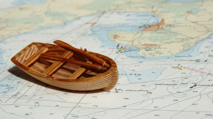
Table of Contents
- Understand What a Nautical Chart Actually Is
- Learn to Decode Chart Symbols
- Master Depth Soundings and Contour Lines
- Pay Attention to Tides and Water Levels
- Use the Compass Rose to Determine Direction
- Measure Distance with Nautical Miles
- Identify Navigational Hazards
- Check for Aids to Navigation (ATONs)
- Always Cross-Check with GPS and Apps
- Practice by Plotting Real Routes
- You’re Ready to Navigate Like a Boss
- FAQs – How To Read Nautical Charts Like a Pro
Understand What a Nautical Chart Actually Is
Think of a nautical chart as your marine roadmap, but with a serious upgrade. While a typical roadmap shows highways and landmarks, a nautical chart is a detailed marine navigation tool that reveals the hidden underwater world. These aren’t just fancy maps – they’re precision instruments that NOAA has been crafting for nearly two centuries as the nation’s nautical chart-maker.
Unlike regular maps that show roads and buildings, nautical charts pack way more punch. They show water depths, underwater hazards, tide information, and navigation aids that could mean the difference between a smooth sail and a costly mishap. When mariners use these charts for route planning and identifying safe passages, they’re looking at meticulously surveyed data that’s been updated to keep them safe on the water.
Pro Tip: Always check the chart’s publication date and edition number (found in the lower corners). Older charts may not display recent changes to channels, new hazards, or updated navigation aids that could impact your route.
Learn to Decode Chart Symbols
Charts are loaded with symbols, and without understanding what these little marks mean, you’re essentially trying to navigate blindfolded. U.S. Chart No. 1 is your bible here – a 130-page guide that describes every symbol, abbreviation, and term used on NOAA nautical charts and electronic displays.
The good news? Edition 13 of U.S. Chart No. 1 is available as a free download from Coast Survey’s website. This isn’t just recommended reading – it’s essential for safe navigation. The International Hydrographic Organization (IHO) sets many of these standards, so once you learn these symbols, you’ll be able to read charts from around the world.
Common symbols include geometric shapes for buoys, star-like symbols for lights (often with flash pattern details), numbers for depth indicators, and distinctive markings for wrecks and hazards. Different colors and shapes tell specific stories about what you’ll encounter on the water.
Pro Tip: Download the free Chart No. 1 PDF to your phone or tablet as a quick reference. Even experienced boaters need to look up unfamiliar symbols occasionally.
Related: How to Clean a Boat: A Step-by-Step Guide for Beginners
Master Depth Soundings and Contour Lines
Water depth is arguably the most critical information on any chart. Those numbers scattered across the water areas aren’t random – they’re depth measurements that could save your boat from an expensive grounding. But here’s the key: you need to know what units they’re using.
Depths are shown in either feet, fathoms (6 feet), or meters (3.28 feet). Check the large magenta letters at the top right corner of your chart to see which unit applies. A fathom equals six feet, though since 1992, U.S. charts have been switching to meters for international consistency.
Depth contour lines connect points of equal depth, creating an underwater topographic map. When these lines are close together, you’re looking at a steep underwater slope. When they’re far apart, the bottom slopes gradually. All depths are referenced to Mean Lower Low Water (MLLW), giving you a safety margin during most tide conditions.
Pro Tip: Add your boat’s draft plus a safety margin (usually 2-3 feet) to determine your minimum safe depth. Mark this “danger depth” on your chart with a colored pencil for quick reference.
Pay Attention to Tides and Water Levels
Even with accurate depth soundings, tides can dramatically change your underwater clearance. That 8-foot depth marking might shrink to just 4 feet at low tide, turning a safe passage into a grounding nightmare. This is where tide tables become your best friend.
Chart depths represent Mean Lower Low Water (MLLW), so actual depths are usually greater than shown. However, when tide tables show negative entries, you’ll have less water than the chart indicates. You’ll need to add or subtract the tide height from charted depths to calculate your real-time water depth.
NOAA provides comprehensive tide data through tide stations and real-time observations. These resources help you time passages through shallow areas and make informed decisions about when it’s safe to navigate marginal waters.
Pro Tip: Use your phone’s tide app to set alerts for optimal tide windows in shallow areas. Plan your departure times around favorable tides rather than trying to force a passage during low water.
Use the Compass Rose to Determine Direction
Direction finding involves more than pointing your bow where you want to go. You’ve got to account for magnetic variation – the difference between true north (pointing to the North Pole) and magnetic north (where your compass needle points). This difference varies by location and changes slightly over time.
Every chart shows the local magnetic variation near the compass rose. When taking bearings from your chart, you’re measuring true directions. But your compass reads magnetic directions, so you’ll need to apply the variation correction. Remember the rhyme: “True Virgins Make Dull Company” – when going from True to Magnetic, add Easterly variation and subtract westerly variation.
Place your parallel ruler along your desired course line, then transfer that angle to the compass rose to read your heading. This gives you the true bearing, which you’ll then convert to magnetic for your compass.
Pro Tip: Write the local magnetic variation on a piece of tape and stick it near your compass. This prevents confusion when you’re busy navigating and need quick bearing conversions.
Measure Distance with Nautical Miles
Distance measurement on nautical charts uses nautical miles, not the statute miles you use on land. One nautical mile equals 1.15 statute miles and represents one minute of latitude. This makes distance measurement surprisingly easy once you know the trick.
Use dividers to measure between two points, then transfer that measurement to the latitude scale on either side of your chart. Count the minutes between the divider points – each minute equals one nautical mile. If your measurement is too wide for your dividers, set them to a convenient distance (like 5 miles) and “walk” them along your route, counting as you go.
Understanding chart scales helps, too. A 1:20,000 scale means one inch represents about 0.27 nautical miles, while larger scale charts show smaller areas in greater detail. This affects how precisely you can measure distances and plot courses.
Pro Tip: Keep your dividers set to common distances like 1, 5, or 10 nautical miles. This speeds up distance estimation and route planning without constantly measuring against the latitude scale.
Identify Navigational Hazards
Charts are packed with warnings about underwater obstacles that could ruin your day on the water. Learning to spot and interpret hazard symbols is essential for keeping your boat in one piece. Submerged rocks appear as small circles or asterisks, often with depth information if surveyed.
Wrecks get their distinctive symbols, with some marked as dangerous to navigation while others might be deep enough to pass over safely. Pay attention to whether hazards are always submerged or only covered at certain tide levels. Areas of shoal water often get a blue tint or special depth contours.
Charts also mark restricted areas where navigation is prohibited or limited. These might include military zones, marine sanctuaries, or underwater cable areas. Ignoring these restrictions isn’t just dangerous – it could land you in legal trouble with the authorities.
Pro Tip: Use a yellow highlighter to mark all hazards along your planned route before departing. This creates a visual “danger zone” that’s easy to spot while navigating and helps avoid last-minute surprises.
Related: 7 Common Boat Engine Problems and How to Fix Them
Check for Aids to Navigation (ATONs)
Aids to Navigation are your friends on the water, guiding you safely through channels and helping confirm your position. The U.S. uses the IALA lateral marking system, where red markers stay on your starboard (right) side when returning from sea, and green markers on your port (left) side.
Chart symbols for lighted aids include flash patterns, colors, and visibility ranges. A marking like “Fl R 4s” indicates a red flashing light with 4 seconds. These characteristics help you identify specific aids at night or in poor visibility conditions.
Different buoy shapes serve different purposes – can buoys mark starboard channel edges, nun buoys mark port sides, and special buoys might indicate anchorage areas or swimming zones. The International Association of Marine Aids to Navigation and Lighthouse Authorities (IALA) Maritime Buoyage System standards ensure consistency.
Pro Tip: At night, time the flash patterns of lights with your watch to confirm you’re identifying the correct aid. Many lights have similar colors but different timing sequences.
Always Cross-Check with GPS and Apps
Modern navigation combines traditional chart reading with electronic aids for maximum accuracy. Electronic Navigational Charts (ENCs) are vector datasets that work with GPS chartplotters and apps like Navionics, providing real-time positioning and collision avoidance features.
NOAA’s Electronic Chart Display and Information System (ECDIS) technology, originally designed for commercial vessels, now powers many recreational navigation systems. These tools overlay your GPS position on electronic charts, making navigation more intuitive and reducing position-fixing errors.
However, GPS can fail, signals can be jammed, and electronics can get waterlogged. Paper charts remain essential backup tools that don’t need batteries or satellite signals. The smartest approach combines both electronic convenience with paper chart reliability.
Pro Tip: Always carry updated paper charts for your cruising area, even when using electronic navigation. When your chartplotter fails 20 miles offshore, you’ll be grateful for that old-school backup.
Practice by Plotting Real Routes
The best way to master chart reading is hands-on practice with real scenarios in familiar waters. Start simple with a local bay or harbor where you know the area, then progress to more complex navigation challenges as your skills develop.
Choose a route from a familiar marina to a nearby anchorage, identifying hazards, aids to navigation, and depth considerations along the way. Use quality dividers and parallel rulers for accurate measurements and bearing plots. Practice converting between true and magnetic bearings, calculating arrival times based on distance and speed.
Start with straightforward point-to-point routes, then advance to passages with multiple course changes, tide considerations, and hazard avoidance. Plot alternative routes in case weather or conditions change. Essential plotting tools like dividers, parallel rulers, and pencils remain the most reliable way to work with paper charts.
Pro Tip: Practice plotting courses in comfortable conditions at home before you need these skills on the water. Trying to learn chart plotting while bouncing around in rough seas is a recipe for mistakes.
You’re Ready to Navigate Like a Boss
Congrats! You’ve just leveled up from chart-confused to navigation ninja. These ten skills – symbol decoding, depth reading, tide calculations, and hazard spotting – are your ticket to confident boating. You now speak the language of charts, understanding what every squiggle and number means for your safety on the water.
Combining old-school chart skills with modern GPS gives you bulletproof navigation that works even when tech fails. The best part? You’re ahead of most weekend warriors who wing it without proper chart knowledge. Practice these techniques in familiar waters first, then watch your confidence soar on longer trips. Time to grab those dividers and start plotting real routes – you’ve got the skills to navigate anywhere safely!
FAQs – How To Read Nautical Charts Like a Pro
How to read a nautical chart coordinates?
Nautical chart coordinates use latitude and longitude lines. Latitude runs horizontally (east-west) and longitude runs vertically (north-south). Find your position where these lines intersect. Coordinates are written as degrees, minutes, and seconds (e.g., 41°24’12″N, 70°04’56″W). Use the chart’s border scales to plot precise positions with dividers or GPS plotters.
What do the numbers mean on a nautical chart?
The scattered numbers across water areas show depth measurements at that specific location. Check the chart’s title to see if depths are in feet, fathoms (6 feet), or meters. All depths reference Mean Lower Low Water (MLLW), so actual water is usually deeper. Numbers near land show elevation heights above sea level.
How do you read nautical chart symbols?
Download NOAA’s Chart No. 1 – it’s your free symbol decoder with over 130 pages of every marking. Common symbols include circles for buoys, star-like marks for lights, and special shapes for hazards like wrecks. Colors matter too – blue indicates shallow water, while magenta shows important navigation information. Practice with familiar waters first.
How to read nautical buoys?
Buoys follow the “red right returning” rule – keep red buoys on your starboard (right) side when returning from sea. Green buoys stay on your port (left) side. Different shapes indicate channel sides: can buoys mark starboard edges, nun buoys mark port sides. Chart symbols show each buoy’s color, shape, and light characteristics for easy identification.