Stretching roughly 3,000 miles along the Atlantic and Gulf coasts, the Intracoastal Waterway is one of America’s greatest boating treasures. Sailing the Intracoastal Waterway means trading unpredictable offshore swells for a sheltered network of rivers, bays, sounds, and canals — the kind of protected passage that draws everyone from weekend warriors to full-time liveaboards doing the annual snowbird migration south. The U.S. Coast Guard keeps a watchful eye over much of it, adding real comfort when navigating unfamiliar waters. These eight tips will help you make the most of every mile.
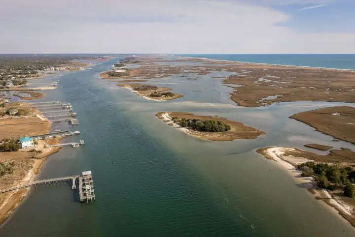
Table of Contents
- Tip 1 – Plan Your Route
- Tip 2 – Understand Tides & Currents
- Tip 3 – Check Your Vessel & Equipment
- Tip 4 – Watch the Weather
- Tip 5 – Know the Rules & Regulations
- Tip 6 – Use Proper Anchoring Techniques
- Tip 7 – Manage Fuel & Supplies
- Tip 8 – Stay Connected & Safe
- Tip 9 – Tap Into the ICW Cruising Community
- The ICW Is Yours — Go Earn It
- FAQs – Sailing the Intracoastal Waterway
Tip 1 – Plan Your Route
Good route planning starts well before you cast off. NOAA nautical charts are the gold standard for ICW navigation — they give you accurate depth soundings, bridge clearances, and hazard markers. Pair those with a digital tool like Navionics, and you’ve got a dynamic, real-time picture of what’s ahead. Before leaving the dock, mark out fuel stops, anchorages, and marina options every 30 to 50 miles. Local marinas along the route are a fantastic resource — staff often know the waterway intimately and can tip you off to recent shoaling or tricky currents in their area.
- Download NOAA charts and load them into Navionics before departure
- Mark marinas, fuel docks, and anchorages every 30–50 miles
- Call ahead to local marinas for real-time conditions and local intel
- Always have a backup overnight stop planned in case of delays
Tip 2 – Understand Tides & Currents
On the ICW, the difference between a smooth passage and an embarrassing grounding often comes down to timing your tides. In stretches like the Carolinas and Georgia, water depths at low tide can drop dramatically, leaving deeper-keeled sailboats in a real bind. Check NOAA tide charts religiously, especially before entering inlets or transiting known shallow areas. Tidal currents can also run 2–3 knots in Georgia’s marsh-lined rivers — plan to run with the current when you can for free speed and reduced fuel consumption.
- Check NOAA tide charts every morning before getting underway
- Cross shallow bars on a rising tide whenever possible
- Ask local harbor authorities about current hot spots along your route
- Factor tidal current direction into your daily mileage planning
Related: 7 Best Places to Sail in the US – Time to Explore America’s Top Sailing Spots!
Tip 3 – Check Your Vessel & Equipment
A thorough vessel check before heading out is essential. Start with the engine — belts, hoses, fluid levels, and impeller. Then work through your electronics: chartplotter, depth sounder, VHF radio, and navigation lights. A depth sounder is non-negotiable on the ICW. The U.S. Coast Guard offers a free Vessel Safety Check program where trained volunteer examiners go through your boat stem to stern — it takes about an hour and gives you a solid baseline. Life jackets, in-date flares, charged fire extinguishers, and a stocked first aid kit round out the essentials, all available at most boating supply stores.
- Inspect engine components, belts, hoses, and fluid levels before departure
- Test your chartplotter, depth sounder, VHF, and navigation lights
- Schedule a free U.S. Coast Guard Vessel Safety Check
- Confirm all safety gear — PFDs, flares, fire extinguishers — is current and accessible
Tip 4 – Watch the Weather
The National Weather Service issues dedicated marine forecasts broken down by zone, covering wind speed, wave height, visibility, and small craft advisories. Make it a habit to check them morning and night while underway. Apps like PredictWind or Windy give a more visual, granular look at incoming conditions, and many experienced ICW cruisers run multiple sources simultaneously. Sailors who’ve been doing this for decades will tell you that some of their best memories came from unexpected weather delays — a quiet anchorage discovered by necessity, or new friends made at a marina while waiting out a squall line.
- Check the National Weather Service marine forecasts every morning and evening
- Use PredictWind or Windy for visual, zone-specific weather modeling
- Cross-reference at least two weather sources before making passage decisions
- Build flex days into your itinerary so weather delays don’t create pressure
Tip 5 – Know the Rules & Regulations
Speed limits and no-wake zones are strictly enforced on the ICW, particularly near residential docks, marinas, and wildlife refuges. The U.S. Coast Guard takes violations seriously, and running through a no-wake zone at speed is a fast way to earn a citation. Commercial vessels and tow boats have right-of-way in many narrow channel situations. For bridges, always hail the tender on VHF Channel 9 or 16 as you approach. Websites like ActiveCaptain and local marina associations maintain updated bridge schedules — worth bookmarking before you head out.
- Respect all posted no-wake zones — violations carry real fines
- Yield right-of-way to commercial vessels and tow boats in narrow channels
- Hail bridge tenders on VHF Channel 9 or 16 before approaching
- Check ActiveCaptain or local marina associations for current bridge schedules
Tip 6 – Use Proper Anchoring Techniques
For ICW anchoring, a plow-style anchor, like a Delta or a modern scoop anchor like a Rocna, sets reliably in the soft mud and sand bottoms common along the waterway. Scope matters — a 7:1 ratio of rode to depth is a solid starting point in tidal anchorages, more if current or weather is building. Not every spot on the ICW is a legal anchorage, so checking ActiveCaptain notes, local harbor authority websites, or calling a nearby marina before dropping the hook is time well spent.
- Use a plow or scoop-style anchor for the best holding in mud and sand
- Set a minimum 7:1 rode-to-depth scope ratio in tidal anchorages
- Verify anchoring is permitted before settling in for the night
- Check ActiveCaptain or call a local marina for anchoring restrictions in the area
Tip 7 – Manage Fuel & Supplies
Fuel docks vary wildly in spacing along the ICW — some stretches have options every 15 miles, others stretch 60 miles between reliable stops. Never let your tank drop below a third, and always know where the next fuel dock is before you need it. Navionics and Marinas.com both let you filter specifically for fuel availability along your route. For provisioning, stock up on non-perishables near larger towns, keep a rolling 3-day buffer of food and water aboard, and top off your fresh water tanks whenever the opportunity presents itself.
- Never let fuel drop below one-third of your tank capacity
- Use Navionics or Marinas.com to pre-identify fuel docks along your route
- Stock up on provisions near larger towns — remote stops are limited and pricey
- Keep a 3-day buffer of food and water aboard at all times
Tip 8 – Stay Connected & Safe
A VHF marine radio is how you talk to bridge tenders, monitor NOAA weather broadcasts, and call for help in an emergency. Channel 16 is the universal hailing and distress channel, monitored by the U.S. Coast Guard around the clock. DSC capability paired with a registered MMSI number automatically sends your GPS coordinates when you hit the distress button — a feature that’s genuinely saved lives. For stretches where cell service drops out, a satellite communicator like a Garmin inReach gives you two-way messaging and SOS capability. Always share your float plan with someone onshore before departure.
- Keep the VHF radio on and monitoring Channel 16 at all times underway
- Register your MMSI number to enable automatic GPS distress signaling via DSC
- Carry a Garmin inReach or similar satellite communicator for remote stretches
- Share a detailed float plan with a trusted contact before every passage
Related: Why Is Haulover Inlet So Dangerous? The Truth Behind Florida’s Deadliest Waterway
Tip 9 – Tap Into the ICW Cruising Community
One of the most underrated advantages of sailing the ICW is the tight-knit community that travels it every year. Platforms like Waterway Guide and ActiveCaptain are packed with real-time, crowd-sourced reports from cruisers who were in the same stretch of water days — or even hours — before you. Shoaling updates, bridge schedule changes, marina reviews, and hazard warnings all live in these communities, and they’re regularly more current than any official chart update. Beyond the apps, the ICW cruising community is remarkably generous on the water itself. It’s common for boats traveling in the same direction to form informal convoys, share bridge openings, and pass along local knowledge over VHF. Don’t be shy about hailing a fellow cruiser — most ICW veterans are happy to share what they know.
- Create a free account on Waterway Guide and ActiveCaptain before departure
- Read recent cruiser reports for each stretch before you transit it
- Monitor VHF Channel 16 and 13 for real-time communication with nearby vessels
- Don’t hesitate to hail fellow cruisers — local knowledge shared on the water is priceless
The ICW Is Yours — Go Earn It
Sailing the Intracoastal Waterway comes down to preparation, timing, and a healthy respect for the water. Plot your route with NOAA charts and Navionics, time your tides through the tricky shallow stretches, keep your vessel dialed in, and stay ahead of the weather. Know the rules, anchor smart, manage your fuel, and keep your VHF on Channel 16. Do all that, and the ICW stops being something you navigate and starts being something you genuinely experience — 3,000 miles of coastline, hidden anchorages, waterfront towns, and open water that most people only ever see from the shore.
FAQs – Sailing the Intracoastal Waterway
How long does it take to sail the Intracoastal Waterway?
Most cruisers cover the ICW in three to four weeks, averaging 40 to 70 nautical miles per day. That said, plenty of sailors stretch it to two or three months, stopping to explore waterfront towns and hidden anchorages along the way. Your pace, your boat’s speed, and how many times you get sidelined by weather will all factor in.
How far can you go on the Intracoastal Waterway?
The ICW stretches roughly 3,000 miles in total, running from Manasquan Inlet in New Jersey all the way to Brownsville, Texas. The Atlantic portion alone — Norfolk, Virginia to Miami, Florida — covers over 1,000 nautical miles. Ambitious cruisers can connect the ICW to the broader Great Loop, a 6,000-mile continuous waterway route that circles the eastern portion of North America.