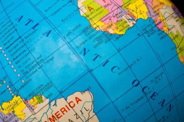
Sailing across the North Atlantic is probably the most common bluewater passage on the planet—but there’s still plenty of adventure to be had. Famous cruising grounds frame the Atlantic. From Northern Europe, the Baltic Sea, and the Mediterranean on the eastern side to the fabulous Caribbean, Bahamas, and US east coast on the west side, the Atlantic has some bucket-list-worthy destinations for the voyaging sailor.
So how long of a journey is it, and how do you go about planning it? Here’s a look and how, when, and where to tackle when you’re ready to take on the North Atlantic.
Table of Contents
- How Many Miles is It To Cross the Atlantic, and How Long Does It Take?
- Best Routes For Crossing the Atlantic
- Weather Hazards—When is the Best Time of Year to Cross the Atlantic?
- How Big of a Sailboat Do You Need to Cross the Atlantic?
- North Atlantic Destinations to Think About
- Navigating The Atlantic
How Many Miles is It To Cross the Atlantic, and How Long Does It Take?
We’ll look into the how’s and why’s in a moment, but for now, here are some rough numbers for some typical Atlantic crossings. We’ll assume an ordinary 40-foot cruising sailboat boat that plans passages at a conservative 6.5 knots.
Westbound to the Caribbean, departing from Lisbon, Portugal by way of the Canary Islands
Distance, Lisbon to Antigua (Lesser Antilles)—3,400 nm
Time, assuming 6.5 knots average—21 days, 19 hours
Eastbound to England, via Bermuda and the Azores
Distance, Antigua to Portsmouth, UK—4,000 nm
Time, assuming 6.5 knots average—25 days, 15 hours
These routes are for crossing the entire Atlantic Ocean—and there are stops along the way that most sailors will call on. The Canary Islands are a favorite stop and a great place to wait for the perfect weather before departing for the Lesser Antilles–some 3,000 or so miles to the west.
Headed eastward across the Atlantic, both Bermuda and the Azores represent waypoints along the way are our favorite ports of call. It’s just under 2,000 nm from Hamilton, Bermuda, to Horta in the Azores.
So longest leg going in either direction is about 3,000 miles, which means the longest legs are seldom more than 15 to 20 days. And most cruisers complete the Atlantic circuit over two years or more, so these long passages are few and far between for the typical voyaging sailboat crew.
Best Routes For Crossing the Atlantic
Like all of the world’s passage routes, the Atlantic routes have been used for centuries. The prevailing trade winds outline the general path.
Trade Winds
The Atlantic’s primary driver of weather is the semi-permanent Bermuda-Azores High. Its name comes from its approximate geographic center—it is usually centered somewhere between 25 and 35 degrees north latitude.
In that area, the center of the high causes sinking, still air. It is not uncommon to become becalmed in this zone. The area is called the Sargasso Sea for the vast amounts of seaweed that float in the still currents.
It is also called the Horse Latitudes, as it is here that sailing ships could get stuck for weeks without making any progress. They’d wind up becalmed so long that eventually the crew ran low on water and would need to get rid of their cargo to save supplies—so they threw the horses over the side.
The Bermuda-Azores High airmass creates steering currents around the entire Atlantic basin. Winds flow clockwise around areas of high pressure in the northern hemisphere, so if you connect the continental coasts around the perimeter of the North Atlantic, you’ll have a rough idea of what the cruising routes look like.
If you’re starting in Europe, the route goes south to the Canary Islands off of the northwest shore of Africa. From there, it crosses downwind to the Eastern Caribbean. The most common landfall point is the island of Antigua, but you could steer for any of the destinations in the Lesser Antilles.
This route follows the “southeasterly trade winds,” which flow around the southern end of the high-pressure system.
From the Caribbean, boats typically follow the US east coast northward. From there, they can swing east toward Bermuda or continue north to Maine and Nova Scotia.
To return to Europe, the route follows the mid-latitude prevailing westerlies. These winds will push a boat toward the Azores and then onto Europe.
Along the coast of Europe, the high pressure provides north winds for the passage back to southern Europe and the Mediterranean.
Gulf Stream
Ocean currents play an essential factor in passage planning, as well. And the North Atlantic has a significant and powerful ocean current that must be considered—the Gulf Stream.
The’ Steam kicks north from the Caribbean Sea and threads the needle between Cuba and Florida before turning northbound. It hugs the coast of Florida and then curves toward North Carolina before heading out to sea.
The warm water carried from the Caribbean moderates northern Europe’s weather and keeps temperatures moderate. It’s has been described as one of the world’s most powerful and important currents.
For most of its length, the Gulf Stream flows at about 1.5 to 2 knots. But at certain spots near Florida, it reaches a maximum velocity of over 3 knots. The Gulf Stream is so strong in this part of the world that only fool-hardy sailors would ignore its effects on a passage. If you’re following the Atlantic circuit, the current represents an enormous speed boost.
But it’s also strong enough to kick up dangerous seas in some wind conditions. And in the North Atlantic, its warm water regularly creates or intensifies severe weather that boats will want to avoid.
Weather Hazards—When is the Best Time of Year to Cross the Atlantic?
Crossings of the North Atlantic must consider two crucial weather hazards to determine when they want to proceed. These two worst seasons frame the cruising seasons—leaving only small windows of optimal weather for safe passages.
Winter Storms
In the winter months, the Bermuda High is more dramatically affected by fluctuations in the Jet Stream and upper-level winds. Cold fronts dig deep into the tropics, and with them, they drag low-pressure areas that often break off and produce strong gales at sea.
Winter gales can occur anytime in the cooler months but are most common from January until April. Gales most affect the northern latitudes and make the thought of any eastbound sailing untenable until the early summer.
In addition to high latitudes winter gales, variations in the Jet Stream and cold fronts can interrupt the typical trade wind pattern farther south.

Hurricane Season
The Atlantic hurricane season officially runs from June 1 until November 30, but tropical weather systems have been recorded both before and after these dates.
The important thing to realize about Atlantic hurricanes is that they are cruisers, too—they ride the same prevailing winds around the Atlantic circuit that sailors like to. They commonly form as tropical waves and areas of disturbed weather off of the coast of northern Africa. Then, they follow the prevailing easterlies into the Caribbean basin, where they get wrapped up in northbound winds that steer them for either the US east coast or the cruising waters of the North Atlantic.
Crossings during hurricane season require some careful risk management. Strong and dangerous storms are rare until late July, with the peak months being mid-August through late September. Furthermore, some seasons are more active than others. Most cruisers wait until November before carefully setting out for the tropical latitudes.
How Big of a Sailboat Do You Need to Cross the Atlantic?
When you look at the distances covered and the time at sea, it’s clear that crossing the Atlantic is one of the most intense bluewater passages you can undertake. Thrill-seekers have done the passage in boats under 10 feet—heck, some have even rowed across in rowboats.
But these aren’t your run-of-the-mill cruisers looking to see the world; they’re folks with entirely different goals. Most cruisers set sail in boats that are around 40 feet long.
The length of the favored cruising vessel seems to increase a little bit every few years. In the 1970s, Lin and Larry Pardey famously cruised from America to Europe on Serrifin, a Lyle Hess-designed 28-foot Bristol Channel Cutter. They cruised for decades and visited many countries, all without even having an engine onboard.
By today’s standards, even that journey leans to the “adventure seeker” category. But many of the Pardey’s requirements from their cruising boat remain true today. They should be salty sailors that can safely tackle any condition. They should be robustly constructed and safe in any condition.
If you’re interested in the sort of boats that can make the trip, don’t miss our article on the best bluewater sailboats.

North Atlantic Destinations to Think About
One of the reasons so many people ask how long it takes to cross the Atlantic is that there are fabulous cruising destinations everywhere a sailor looks. Unlike some other parts of the world, like the South Pacific, the destinations are more or less located around the loop course that a boat would have to take to sail across the Atlantic anyway. The result is that the concept of sailing a Northern Atlantic circuit makes the journey worth the extra effort.
Here are just a few of the destinations that lay around the Northern Atlantic Circuit. Of course, you could skip some or do them all. But there are an immense amount of places one can check out by sailboat in the Atlantic waters.
The Caribbean
Of course, the poster-child of Atlantic cruising are the exotic islands of the eastern Caribbean. The Caribbean Sea lies between North and South America and is separated from the open Atlantic by a string of islands—the Lesser and Greater Antilles.
Those islands make up the cruising grounds of the Eastern Caribbean. Famous destinations include the Virgin Islands (US, British, and Spanish), St. Martin, St. Barts, St. Vincent, and Grenada. Nearly every island is an independent nation or an overseas territory or colony, meaning that cruising here is a diverse cultural adventure. All of the world’s languages, cultures, and customs blend in this laid-back and tropical melting pot.
Also of note is the coastal cruising grounds of the Western Caribbean. Mexico, Belize, Guatemala, and Panama are the primary attractions here. Many experienced cruisers liken the San Blas Islands in Panama as a little taste of the South Pacific.
The Bahamas
The Bahamian archipelago lies in the Atlantic basin, not in the Caribbean as it is commonly associated. The chain contains more than 600 islands, cays, and islets, and its geographic area is as big as all of the nations of the eastern Caribbean combined. The Commonwealth of The Bahamas has been an independent country since 1973.
US East Coast
The US East Coast is home to the Atlantic Intracoastal Waterway (ICW), a semi-inland route that connects many of the east coast’s cruising grounds. Florida marks the southern limit, with destinations like the Florida Keys, Tampa Bay, and Biscayne Bay.
Additionally, the entire US coast is lined with port towns and fantastic cruising opportunities. North Carolina’s Outer Banks and the Chesapeake Bay are rural, with many anchoring and exploring options.
Farther north, Long Island Sound and the Gulf of Maine are also popular destinations.
Bermuda
About 600 nm east of North Carolina lies the tiny island nation of Bermuda. This waypoint is a common stop-over point on an Atlantic circuit. For sailors continuing to Europe from points south, Bermuda’s location makes it a good stop before continuing to the Azores.
Azores
The volcanic Azore Islands are an autonomous region of Portugal. They lie 800 km west of that country in the middle of the Atlantic. Their unique position puts them perfectly in line with Bermuda and Europe for eastbound trips—so it’s no surprise that they’re a favorite stop along the way.
From the Azores, boats can head in any direction they like to the continent or UK.
Northern Europe
Following the circuit clockwise, the first European landfall is somewhere around Ireland or Scotland. This is the gateway to the cruising grounds surrounding the North Sea and farther into the Baltic. The islands and rural routes around Denmark, Norway, and Sweden are of prime interest to most sailors.
Mediterranean
Along the Bay of Biscay, the windward coasts of France and Spain are known for their rough seas and grueling passages. But continuing the Atlantic circuit through this section leads you to Gibraltar and the entrance to the Mediterranean Sea. The Spanish islands, the French Riviera, Italy, Greece, Croatia, and Turkey, are the primary cruising countries.
Canary Islands
Heading West to the Caribbean from the Med, the Spanish Canary Islands are a prime waypoint that many boats enjoy calling on. In Las Palmas, you are likely to cross paths with many other sailors on the same route as yourself.
Navigating The Atlantic
There are many reasons why someone would want to sail across the Atlantic. Compared to other parts of the world, the Atlantic has some of the most interesting and accessible bluewater sailing around. The destinations in the area are superb, but as any true salty sailor will tell you, the adventure is in the journey, not just the destination.
If you’d like to learn more about the passages described here, check out Jimmy Cornell’s World Cruising Routes. It is one of the best references for planning long voyages and ocean passages, and it describes all factors, including weather, currents, trip lengths, and times.